Need help choosing,
advice on transport or payment?
Use the chat or contact form.
We will be happy to help you.
We deliver throughout the European Union.

🏪 VÝDEJNÍ MÍSTO
pro Zboží v akci.eu & DPD Pickup
📦 Vyberte si zboží online – vyzvedněte si ho u nás!
🛍 Objednávky z e‑shopu zbozivakci.eu
🚚 Zásilky doručené přes DPD Pickup
🕒 Otevírací doba
Pondělí – Pátek: 7:00 – 18:00
📞 [773 836 472, 724 077 518]
✅ Rychle
✅ Pohodlně
✅ Bez čekání
| List Number: | 02104 |
| EAN: | 9788087380192 |
| Warranty: | |
| Manufacturer: | Geodézie |
| Price excluding VAT: | 78,40 CZK (3,41 €) |
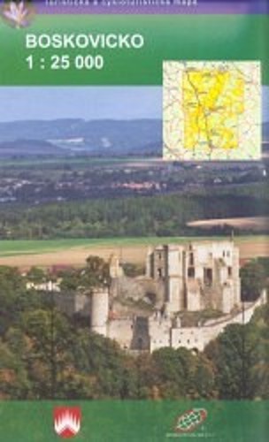
Vydání: 1., 2010 | Velikost složené mapy: cca 18 x 11 cm, plastový obal
Kunštát - Letovice - Boskovice - Velké Opatovice - Jevíčko - Černá Hora - Rájec-Jestřebí - Ostrov u Macochy - Blansko
Podrobná mapa zobrazuje základní polohopisné a výškopisné informace např. silnice, zpevněné a nezpevněné cesty,železnici, sídla a jejich části včetně osad a samot, vodní plochy a toky, ostatní plochy (např. lesy, zahrady a sady, vinice, chmelnice), výškové kóty, vrstevnice po 10 m, ...
Obsahuje pásové a místní turistické značení, turistické směrovníky, kilometráž cykloturistické trasy naučné stezky turistické lyžařské trasy, sjezdové tratě, lanovky a vleky (jsou-li v zobrazovaném území) jezdecké trasy a samozřejmě zobrazuje pro turisty atraktivní místa - hrady a zámky, rozhledny a místa rozhledu, zříceniny a jiné památky, muzea a galerie, koupaliště, vybrané restaurace a ubytovací zařízení,...
Mapu dodáváme složenou v praktickém plastovém obalu.


+ rychlé, spolehlivé
+ Dobrá komunikace
+ Super rychlé doručení
+ Hezký výběr zboží
+ Dostali jsme dárek k nákupu
Spokojenost
+ Rychlost dodání, seriózní jednání.
+ Rychlost dodání, skvělá komunikace
+ Vstřícné jednání a bleskové dodání zboží